
Double click image to zoom in

Click image to open expanded view
Questions & Answers
Have a Question?
Be the first to ask a question about this.
Cicerone
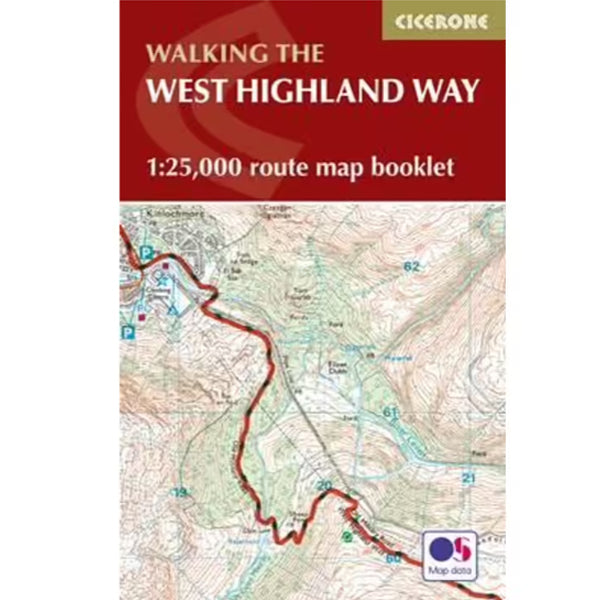
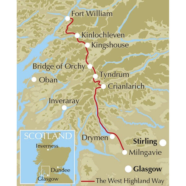
All the mapping you need to complete the 95 mile (153km) West Highland Way, an official Scottish Long Distance Route from Milngavie near Glasgow to Fort William. Showcasing the wild beauty of western Scotland, the trail is a journey from the lowlands to the highlands, passing Loch Lomond then crossing Rannoch Moor before finishing in the shadow of Britain's highest mountain, Ben Nevis. The walk takes roughly a week to complete and is presented in seven stages ranging from 8 to 20 miles.
This booklet of Ordnance Survey 1:25,000 Explorer maps has been designed for convenient use on the West Highland Way. It shows the full and up-to-date line of the route along with the relevant extract from the OS Explorer map legend, and can be used when walking the trail in either direction. Conveniently sized for slipping into a jacket pocket or the top of a rucksack, it comes in a clear PVC sleeve. NOTE An accompanying Cicerone guidebook - The West Highland Way ISBN9781852848576 - describes the full route with lots of other practical, historical and cultural information.
Our on-line store is open 24/7 and we ship Monday through Friday, excluding some holidays. Orders received for products without shipping restrictions on its product page will ship the same business day when received before 12:00 p.m. PST. Orders in high demand will have an estimated production time listed on its product page and will ship according to the date listed.
Got a question or need some advice? Reach out—we're real humans who love talking gear. Whether you're planning your next trip or just looking for the right gear, we're always happy to help. Give us a call, send us an email or drop by the store. We’d love to hear from you!
© 2025, Trek & Travel Powered by Shopify